- My Forums
- Tiger Rant
- LSU Recruiting
- SEC Rant
- Saints Talk
- Pelicans Talk
- More Sports Board
- Fantasy Sports
- Golf Board
- Soccer Board
- O-T Lounge
- Tech Board
- Home/Garden Board
- Outdoor Board
- Health/Fitness Board
- Movie/TV Board
- Book Board
- Music Board
- Political Talk
- Money Talk
- Fark Board
- Gaming Board
- Travel Board
- Food/Drink Board
- Ticket Exchange
- TD Help Board
Customize My Forums- View All Forums
- Show Left Links
- Topic Sort Options
- Trending Topics
- Recent Topics
- Active Topics
Started By
Message
re: I-10 Severe Weather/Flooding Threat Rd. 2- Thursday/Friday
Posted on 5/16/24 at 10:00 pm to AutoYes_Clown

Posted on 5/16/24 at 10:00 pm to AutoYes_Clown
Not sure why Im getting downvoted, its 5,800ft beam height accordingly. I dont place the radars.

 3
3

Posted on 5/16/24 at 10:01 pm to LaBR4
Flights to BTR are being diverted to Florida and Tennessee.

Posted on 5/16/24 at 10:01 pm to AutoYes_Clown
thanks, i was just hoping those numbers were somehow not reaching the ground..

First band has made to BR...business picking up and this ain't even the big one
First band has made to BR...business picking up and this ain't even the big one
This post was edited on 5/16/24 at 10:02 pm

Posted on 5/16/24 at 10:01 pm to Bayou_Tiger_225


Posted on 5/16/24 at 10:01 pm to AutoYes_Clown
Just catching up on this. Are we really looking at a repeat of a few nights ago in the EBR/Ascension area?

Posted on 5/16/24 at 10:02 pm to slackster
Drove home in Humberto and this was very similar. Neighbor has trees down. Only upside is the damage is more narrow and energy restoration is quicker.
Posted on 5/16/24 at 10:03 pm to LaBR4
quote:
and this ain't even the big one
Wait really? This is intense as it is.

Posted on 5/16/24 at 10:03 pm to Bobby OG Johnson

Posted on 5/16/24 at 10:04 pm to lsugolfredman
It’s raining its arse off, with some pretty serious wind gust, had hail earlier.
Reporting live from the back patio, Waffle news
Reporting live from the back patio, Waffle news
Posted on 5/16/24 at 10:05 pm to hendersonshands
quote:
This storm was not fricking around. What just came through Lafayette was intense.
My dude, shite started getting really loud like I’ve never heard before. I looked out the window and the rain was literally sideways. It looked like the apocalypse. Weather never bothers me but I about shite my pants. Grabbed the wife and kids and hid in the closet

Posted on 5/16/24 at 10:05 pm to Bobby OG Johnson
Where are my Jefferson terrace people at? Storm isn’t even here yet and my power went out for about 30 seconds. I think we are in for another outage.
Posted on 5/16/24 at 10:05 pm to TDsngumbo
quote:
Just catching up on this. Are we really looking at a repeat of a few nights ago in the EBR/Ascension area?
Worse.
Posted on 5/16/24 at 10:05 pm to EyeOfTheTiger311
What time was it ?
Posted on 5/16/24 at 10:08 pm to EyeOfTheTiger311
quote:
Acadiana Regional Airport
New Iberia, Louisiana, United States
latitude: 30-01-44N, longitude: 091-53-04W, elevation: 23 ft
Current weather observation
The report was made 20 minutes ago, at 02:46 UTC
Wind 36 mph from the West/Northwest with gusts up to 67 mph

Posted on 5/16/24 at 10:08 pm to lsufan112001
Must be really bad.
I am sitting on an American Airlines DCA-BTR flight. We are sitting on the ground in Pensacola. Couldn’t land in Baton Rouge or New Orleans apparently.
This thing is crowded. Can’t wait to get off of this plane.
I am sitting on an American Airlines DCA-BTR flight. We are sitting on the ground in Pensacola. Couldn’t land in Baton Rouge or New Orleans apparently.
This thing is crowded. Can’t wait to get off of this plane.
Posted on 5/16/24 at 10:08 pm to lsufan112001
quote:
What time was it ?
This was about the 9:30-9:45 time window right at the peak of the tornado warning. EMS alerts were blowing up on our phones
Posted on 5/16/24 at 10:10 pm to dewster
I am not surprised, this storm is bringing the heat right meow…Hopefully it slacks up soon
Posted on 5/16/24 at 10:10 pm to Aspercel
Yeah JT will be done that gerbil running our grid not gonna make it..

Posted on 5/16/24 at 10:10 pm to TDsngumbo
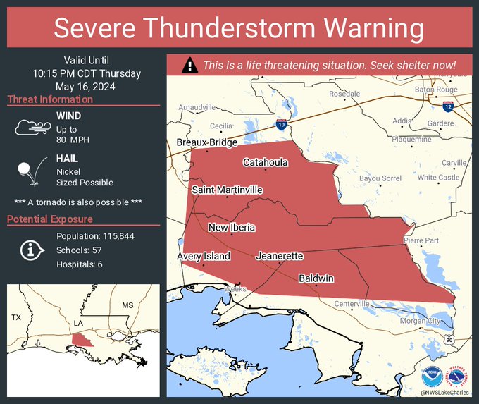
Severe Thunderstorm Warning
National Weather Service New Orleans LA
1005 PM CDT Thu May 16 2024
The National Weather Service in New Orleans has issued a
* Severe Thunderstorm Warning for... Western Ascension Parish in southeastern Louisiana... West Baton Rouge Parish in southeastern Louisiana... Iberville Parish in southeastern Louisiana... Southwestern East Baton Rouge Parish in southeastern Louisiana... Assumption Parish in southeastern Louisiana...
* Until 1045 PM CDT.
* At 1004 PM CDT, severe thunderstorms were located along a line extending from near Atchafalaya National Wildlife Refuge to 9 miles northeast of Lake Fausse Pointe to Sorrel, moving east at 60 mph.
THESE ARE DESTRUCTIVE STORMS FOR THE BATON ROUGE METRO.
HAZARD...80 mph wind gusts and penny size hail.
SOURCE...Radar indicated.
This post was edited on 5/16/24 at 10:11 pm

Posted on 5/16/24 at 10:11 pm to Impotent Waffle
This is easily way worse than what we had in mid-city BR a few days ago.

 Page 7 of 19

Popular
Back to top