- My Forums
- Tiger Rant
- LSU Recruiting
- SEC Rant
- Saints Talk
- Pelicans Talk
- More Sports Board
- Fantasy Sports
- Golf Board
- Soccer Board
- O-T Lounge
- Tech Board
- Home/Garden Board
- Outdoor Board
- Health/Fitness Board
- Movie/TV Board
- Book Board
- Music Board
- Political Talk
- Money Talk
- Fark Board
- Gaming Board
- Travel Board
- Food/Drink Board
- Ticket Exchange
- TD Help Board
Customize My Forums- View All Forums
- Show Left Links
- Topic Sort Options
- Trending Topics
- Recent Topics
- Active Topics
Started By
Message
The Great Flood of 2016: Fill Out Disaster Forms NOW. Link Inside!
Posted on 8/11/16 at 1:00 pm

Posted on 8/11/16 at 1:00 pm
=========================================
Shelters are opening in south Louisiana for those trying to escape the rising waters created by the heavy rains that have fallen across the area.
For those in need of rescue in Baker: (225) 778-0300
For those in need of rescue in Baton Rouge: (225) 389-5000
For those in need of rescue in Central: (225) 367-1254
For those in need of rescue in Livingston Parish: (225) 686-3996
ASCENSION: If you are trying to dial 911 and are unable to get through, call 225-621-8300, option 1. Experiencing issues w/ phone lines.
For those in need of rescue in St. Helena Parish: (225) 222-4413 - press 0
=========================================
=========================================
UPDATE! ?#?FloodDamage? - Please SHARE!!!
For those who have Flood Damage, call and report to ?#?FEMA? at 1(800) 621-3362. You'll need:
-Date of damage
-All SS#'s of those in household
-Insurance company
-Address
-Gross income
They'll take the application over the phone. Also, call the hotline for city assistance at (225) 389-2100. The more calls the better. They still haven't declared it a Federal disaster yet. They are still assessing it and said the worst is yet to come. There may also be assistance thru the IRA. They provide a Disaster loss kit & their number is (800) 829-3676
=========================================
=========================================
Officials encourage anyone impacted by the storm to register damages sustained on the web or by phone at the following:
https://www.disasterassistance.gov
1-800-621-3362
1-800-462-7585
Authorities said registered damage claims in parishes added at a later time will be processed as those parishes are added. The four parishes currently declared federal disaster areas are eligible for the following kinds of assistance:
- Individual Assistance to individuals and households
- Public Assistance for emergency work and the repair or replacement of disaster-damaged facilities
- Hazard Mitigation Grant Program Assistance for actions taken to prevent or reduce long term risk to life and property from natural hazards
=========================================
=========================================
School Closure List: LINK
=========================================
This post was edited on 8/16/16 at 1:23 pm
 109
109


Posted on 8/11/16 at 1:01 pm to tke857
Man, I haven't gotten 10-15" in forever.
Posted on 8/11/16 at 1:01 pm to tke857
I've been keeping up with it on the weather channel, the radar from the local on the 8s shows that the rain is moving south.

Posted on 8/11/16 at 1:02 pm to tke857
will make an interesting RDR
Posted on 8/11/16 at 1:03 pm to tke857
i remember my first 5-7"er.
This post was edited on 8/11/16 at 1:04 pm
Posted on 8/11/16 at 1:05 pm to tke857
quote:
BR & Surrounding areas 10-15" of rain expected through the middle of next week
It's not even flood/monsoon/gray rainy season!
Posted on 8/11/16 at 1:09 pm to tke857
quote:
areas of 10-15"
that's what I say when I look inside my pants every morning
Posted on 8/11/16 at 1:09 pm to tke857
Play stupid games win stupid prizes.

Posted on 8/11/16 at 1:09 pm to tke857
will this affect the first home game of the season?
This post was edited on 8/11/16 at 1:10 pm

Posted on 8/11/16 at 1:31 pm to tke857

Posted on 8/11/16 at 1:44 pm to tke857
10-15" over 7 days is nothing. 10-15" over 7 hours is what gets us worried
Posted on 8/11/16 at 2:22 pm to tke857
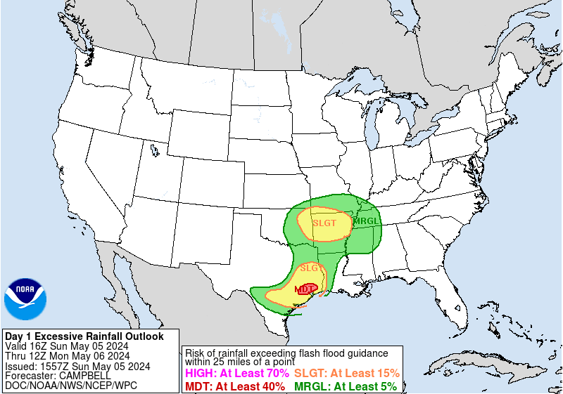
Both the 12z Euro and 12z 4K NAM showing upwards of 25" of rain across portions of S. Louisiana. Obviously, that is probably overdone but there has been pretty consistent agreement b/w the models that someone is going to see some crazy totals.
Latest from NWS WPC:

MESOSCALE PRECIPITATION DISCUSSION 0546
NWS WEATHER PREDICTION CENTER COLLEGE PARK MD
300 PM EDT THU AUG 11 2016
AREAS AFFECTED...SOUTHERN MS...SOUTHEAST AND CENTRAL LA
CONCERNING...HEAVY RAINFALL...FLASH FLOODING LIKELY
VALID 111900Z - 120030Z
SUMMARY...UPGRADE OF EXCESSIVE RAINFALL OUTLOOK TO HIGH RISKED
BASED ON INCREASED DAYTIME HEATING, VERY HIGH MOISTURE AND SLOW
CELL MOTIONS SHOULD POSE FLASH FLOODING CONCERNS ACROSS S MS/SE LA
THROUGH THE EARLY EVENING HOURS.
DISCUSSION...CLEAR SKIES NORTH OF I-10 ACROSS LA INTO S MS HAVE
ALLOWED FOR SFC T TO RISE INTO THE UPPER 80S TO MID
90S...COINCIDENT WITH TDS IN THE MID TO UPPER 70S...REPLENISHING
THE INSTABILITY. GOES-E VISIBLE IMAGERY SHOWS THE APEX OF THE LOW
LEVEL TROF NORTH OF KJAN STARTING TO ALIGN WITH MID TO UPPER LEVEL
SHORTWAVE VORT CENTER...THIS IS CURRENTLY PROVIDING INCREASED
UPPER LEVEL ASCENT AS WELL AS LOWER LEVEL CONVERGENCE TO SUPPORT
INCREASED CONVECTIVE GROWTH OVER THE NEXT FEW HOURS. THE MAIN
HUB/UPPER LEVEL PIVOT REMAINS FURTHER E ALONG THE MS/AL COASTAL
BORDER WITH SLOW DRIFT WHILE 200-250MB OUTFLOW CHANNEL IS PRESENT
WITH THE ENTRANCE REGION ACROSS SE LA. THIS WILL CONTINUE TO
PROVIDE EXCELLENT EVACUATION PARTICULARLY GIVEN THE DIFFLUENCE
WITH NICELY SHAPED ANTICYCLONIC LOOK. CONVECTION NEAR THIS
SOUTHWARD MOVING VORT/CONVERGENCE ZONE WILL BE HIGHLY EFFICIENT
THROUGH A GENERALLY DEEP LAYER...GIVEN SATURATED PROFILES WITH
TPWS OVER 2.5" IN THE AREA OF GREATEST CONCERN (SE LA/NORTH OF
I-10/S MS) RATES IN EXCESS OF 2-2.5" ARE LIKELY AND WITH STRONG
FLUX/MERGERS...WOULD NOT BE SURPRISED OF 1HR TOTALS OVER 3"
POSSIBLE IN ISOLATED SPOTS. OVERALL THE SLOW CELL MOTIONS DUE TO
PROXIMITY TO UPPER LEVEL HUB SHOULD ALLOW FOR SOME VERY HIGH
TOTALS AND PRESENT LIKELY FLASH FLOODING CONDITIONS THOUGH
SUNSET...AS CONVECTIVE VIGOR WILL WANE AS INSTABILITY FROM DAYTIME
HEATING IS EXHAUSTED.
FURTHER WEST ACROSS CENTRAL LA...AN OUTER BAND IS BEGINNING TO
DEVELOP ACROSS THE REGION WHILE THE STATIONARY OLDER CONFLUENCE
BAND FURTHER SOUTH CONTINUES TO REMAIN FED BY LOW LEVEL
CONVERGENCE OUT OF NE TX. EVENTUALLY THE NEWER CONVECTIVE BAND
WILL BE DROP SOUTHWARD AND MELD WITH THE OLDER BAND KEEPING A
THREAT OF INCREASED DURATION/COMPOUNDING TOTALS ACROSS THIS AXIS
THROUGH NIGHT FALL AS WELL.
GALLINA
Latest from NWS WPC:
MESOSCALE PRECIPITATION DISCUSSION 0546
NWS WEATHER PREDICTION CENTER COLLEGE PARK MD
300 PM EDT THU AUG 11 2016
AREAS AFFECTED...SOUTHERN MS...SOUTHEAST AND CENTRAL LA
CONCERNING...HEAVY RAINFALL...FLASH FLOODING LIKELY
VALID 111900Z - 120030Z
SUMMARY...UPGRADE OF EXCESSIVE RAINFALL OUTLOOK TO HIGH RISKED
BASED ON INCREASED DAYTIME HEATING, VERY HIGH MOISTURE AND SLOW
CELL MOTIONS SHOULD POSE FLASH FLOODING CONCERNS ACROSS S MS/SE LA
THROUGH THE EARLY EVENING HOURS.
DISCUSSION...CLEAR SKIES NORTH OF I-10 ACROSS LA INTO S MS HAVE
ALLOWED FOR SFC T TO RISE INTO THE UPPER 80S TO MID
90S...COINCIDENT WITH TDS IN THE MID TO UPPER 70S...REPLENISHING
THE INSTABILITY. GOES-E VISIBLE IMAGERY SHOWS THE APEX OF THE LOW
LEVEL TROF NORTH OF KJAN STARTING TO ALIGN WITH MID TO UPPER LEVEL
SHORTWAVE VORT CENTER...THIS IS CURRENTLY PROVIDING INCREASED
UPPER LEVEL ASCENT AS WELL AS LOWER LEVEL CONVERGENCE TO SUPPORT
INCREASED CONVECTIVE GROWTH OVER THE NEXT FEW HOURS. THE MAIN
HUB/UPPER LEVEL PIVOT REMAINS FURTHER E ALONG THE MS/AL COASTAL
BORDER WITH SLOW DRIFT WHILE 200-250MB OUTFLOW CHANNEL IS PRESENT
WITH THE ENTRANCE REGION ACROSS SE LA. THIS WILL CONTINUE TO
PROVIDE EXCELLENT EVACUATION PARTICULARLY GIVEN THE DIFFLUENCE
WITH NICELY SHAPED ANTICYCLONIC LOOK. CONVECTION NEAR THIS
SOUTHWARD MOVING VORT/CONVERGENCE ZONE WILL BE HIGHLY EFFICIENT
THROUGH A GENERALLY DEEP LAYER...GIVEN SATURATED PROFILES WITH
TPWS OVER 2.5" IN THE AREA OF GREATEST CONCERN (SE LA/NORTH OF
I-10/S MS) RATES IN EXCESS OF 2-2.5" ARE LIKELY AND WITH STRONG
FLUX/MERGERS...WOULD NOT BE SURPRISED OF 1HR TOTALS OVER 3"
POSSIBLE IN ISOLATED SPOTS. OVERALL THE SLOW CELL MOTIONS DUE TO
PROXIMITY TO UPPER LEVEL HUB SHOULD ALLOW FOR SOME VERY HIGH
TOTALS AND PRESENT LIKELY FLASH FLOODING CONDITIONS THOUGH
SUNSET...AS CONVECTIVE VIGOR WILL WANE AS INSTABILITY FROM DAYTIME
HEATING IS EXHAUSTED.
FURTHER WEST ACROSS CENTRAL LA...AN OUTER BAND IS BEGINNING TO
DEVELOP ACROSS THE REGION WHILE THE STATIONARY OLDER CONFLUENCE
BAND FURTHER SOUTH CONTINUES TO REMAIN FED BY LOW LEVEL
CONVERGENCE OUT OF NE TX. EVENTUALLY THE NEWER CONVECTIVE BAND
WILL BE DROP SOUTHWARD AND MELD WITH THE OLDER BAND KEEPING A
THREAT OF INCREASED DURATION/COMPOUNDING TOTALS ACROSS THIS AXIS
THROUGH NIGHT FALL AS WELL.
GALLINA
This post was edited on 8/11/16 at 2:24 pm
Posted on 8/11/16 at 2:33 pm to tke857
How's this going to affect the weather in Punta Canta?
Posted on 8/11/16 at 3:26 pm to tke857
Seems like this thread should be stickied and have all of pj's posts deleted from it

Posted on 8/11/16 at 6:26 pm to tke857
This rain is all the tears that have been shed over the unjust killing of harambe

Posted on 8/11/16 at 7:40 pm to tke857
Couldn't tend to my yard last weekend, guess that isn't happening this weekend either
Posted on 8/12/16 at 6:14 am to tke857
yall be careful out there today!

Posted on 8/12/16 at 7:18 am to tke857
Any idea on where to get sandbags in BR?
Posted on 8/12/16 at 8:22 am to tke857
Anybody know how downtown looks? Especially around Florida and 3rd.

Posted on 8/12/16 at 8:47 am to tke857
how different would this system be if it were in the middle of the gulf?
This post was edited on 8/12/16 at 8:51 am

 Page 1 of 6

Popular
Back to top